Sunday, January 27, 2008

Rainbows and stormclouds

Set the alarm this morning.. was a bit mystified about what it was when it actually went off -that's holidays for you- but nevertheless was ready to start walking from my friend's place at the bottom of Kahuterawa Rd just before 6am.
It was noticeably darker than the last time I started this early, and though I could see quite clearly, cars had their headlights on.

For a change, I kept my light merino on for most of the walk today. I also resorted, for the first time walking this route, to wearing my raincoat in a few places, quite a novelty lately.

Up on Greens Rd there were wild blackberries growing in places. Most were still green, but this bunch were clearly on the red side. I will have to come back walking this way in just a few weeks time! It reminded me of the roadside blackberries I found in rural Ireland and even Jersey in July-August 2006... all the more delicious for their accessibility only to walkers!

The walk along Greens Rd was slightly crazier than I have previously experienced. Usually I am making sure I have enough sunblock on for the rest of the walk at this stage. But today there were some wild winds up this way. In some places the wind was at my back, pushing me forward; and in other places it was in my face, hindering me. Spits of rain were part of the wind. Three runners passed me as I headed up the last hill, and talked about how exciting the wind was. With all the bends in the road, and ridges on the hills, the wind was quite unpredictable.


Right at the top of the hill, I usually get a wonderful view out over the plains, but today I saw a rainbow, and could barely make out the features below.

As I descended from Greens Rd though, I quickly left the worst of the winds behind. Ahead of me, stormy looking clouds loomed, but they came to naught.

For the last hour or so, I finally got to take off my merino jersey, slap on more sunscreen, and keep my sunhat close to my face. As always, my feet felt tired towards the end - this walk must be close to 20- 22 km I think- and as always my feet felt relieved to see this last sign, which means only about 350m left to walk to my car!

Friday, January 25, 2008

Taylor's Mistake Walkway, Christchurch

My last day down south I wasn't flying out until mid-afternoon, and the kiddiwinks of the household, old and young, were away on varied exploits. So my friend suggested a walk to Taylor's Mistake. Beautiful walk, don't miss it. But try not to pick a hot sunny Canterbury day if you can manage it- phew!- did I drink a heap of water!!!
We parked near Sumner and headed uphill, getting a lovely view back over the suburb. First part of the climb was lovely and shaded too.

There was little shade on top, but the view as you walked around on the hills was magnificent. So dry everywhere though. (To think I thought it was getting dry-ish at home.)
The waters were quite rough, as you can see from these wave patterns down in the bay out from Taylor's Mistake itself. Somewhere along this last part of the walk I was desperate for more water.... but luckily, this was 'civilisation', and suddenly, I came across a drinking fountain! I drank a heap of water and filled my water bottle with more.

Down at the beach there were a lot of people in the water. The lifeguards were looking a bit nervous, as the water was really quite rough, with a big undercurrent dragging back out to sea. I hadn't taken my swimming togs, as I usually have an aversion to 'cold east coast currents'. But I paddled anyhow, and the waves soon had me wet up to my thighs. Lovely feeling on such a hot day! Great way to finish a trip to Canterbury.

Okains Bay Camping 2008

Here is a YouTube slideshow of photos from camping at Okains Bay, Banks Peninsula, January 2008. Plus just a few photos at the end from a walk to Taylor's Mistake.

Thursday, January 24, 2008

Okains Bay part 2

Mostly I chose the early mornings to go walking, and climbed up to the far headland several times. Here I am looking back towards the camping ground... in the far bay. You can't see any campers as all the tents are well hidden within the pine trees, which gave shelter on the hot sunny days we had. At the time I was walking, you couldn't see many campers either as mostly they were still deep in their sleeping bags - unless of course they had young children!
From near little Okains Bay I took this photo of the little 'islands', from where you can hear lots of seabirds calling. One morning I got 'divebombed' by a seagull as I passed back through this bay... so I don't like your chances of getting close to the island, even at low tide!

But it sounded like the local Okains Bay museum should also be visited. This became my mission later in the morning on our last full day at the bay. If you left camp when the tide had gone out quite a bit, you could walk all the way up one side of the lagoon to the first bridge.

The historic nature of this area was apparent, with quite a few buildings dating from earlier times. The hillsides were very dry and barren. I was left pondering how much topsoil had been lost when the bush was all cleared from these hills.

There was a lot of bird life to observe walking up along the lagoon, and if you were cunning enough, you could also see some of the crabs before they heard you and scuttled back into their incredibly numerous holes.

Next, by crossing over the bridge, you came to a local metalled road that led all the way up alongside the riverbank, to a point just opposite the village itself. By using the Millennium footbridge, you could then reach the village.

The museum itself was quite amazing, with some very special Maori treasures inside.

There was an array of interesting old buildings, and I was especially taken by this wooden house.
There was a modern meeting house decorated with beautiful tukutuku panels and carvings, and a shed housed two waka that I was told are used on Waitangi Day.
Like many rural museums, there was an eclectic selection on display. One of the saddest display cases for me was one that contained five stuffed extinct huia. But there were a lot of beautiful Maori artifacts. If you visit Okains, make sure you get to the museum.

Friday, January 18, 2008

Camping in Okains Bay

Here is a bit more of a taste of where I have been in the last week. This YouTube video starts and ends with my flight out/in of Palmie and spends most of the time in Okains Bay on Banks Peninsula. At the end there are a few shots from my walk in 33C heat to Taylors Mistake. There are multitudinous shots of a tree I was fascinated by, up the top of a headland at the end of a walkway from Okains.
Soon I will get round to posting a bit more detail about what I got up to. Plus I have a bird for you to identify for me maalie... bound to be a common seabird but I am not sure which one! - will post a photo soon! Meanwhile, enjoy some views of summer down-under.


Monday, January 07, 2008

New Plymouth

OK for all you loyal readers - all two of you - who may well be getting tired of incessant photos from the Gorge and rural Manawatu - despite the fact that local walking really is my life currently!!- I bring you a diversion to New Plymouth. I stayed a couple of nights with my sister. Decided to visit the fossils exhibition at Puke Ariki, the local museum, and to walk there via the beachfront walkway.

After some discussion, we decided the best way for me to get onto the walkway from their place was to divert a short distance down to Nobs Line. I used to flat on Nobs Line, way back, way way back, before dinosaurs were even invented, in my first year of teaching. In fact I used to live on the above featured property, just up from the sea. And my bedroom was right at the front facing out over the ocean. I used to watch the sea in all weathers, and could just go out walking on the sand, literally any time of the day or night. (However, it is true I did not live in this somewhat ugly 'mansion': the simple, rather grotty, house we lived in was removed to construct this!)

As it turned out, it seemed 'meant' that I should go via Nobs Line, straight down onto East End beach. I ended up stumbling upon this newly erected seat, in memory of the mother of an old school friend. I sat there quite peacefully, remembering her.

Just a few people wandered along the sand from Fitzroy.
And just a few walked on the beach towards Paritutu- part of the lip of an old volcano.

And for maalie... when he gets back from his traipsing in Italy.... here is a pohutukawa, beside the sea as it should be.
They have done amazing things to develop the foreshore in New Plymouth, and the walkway was full of people walking. This section was a bit weird though..... the walls behind are so tall that you feel insulated from the land. It would be interesting to walk here when the sea is rougher.
There are a group of sculptors at work at present, using andesite to make their sculptures. Hard stuff this, and power tools much in evidence. Fascinating to stand by and watch their public progress.

I can't leave New Plymouth without showing you Len Lye's windwand. It is controversial and a talking point. Beside the sea, there is no doubt it is dramatic. It was quite calm as I walked this morning: it would be interesting to see what movement happened on a day with more wind.

My next pictures might also be from 'far away'. I am going camping in the South Island with some friends. See you when I get back!

Sunday, December 30, 2007

La draille

I have been a bit immersed in French today, finishing the first of the three TopoGuides for the Chemin de St Jacques, trying to make sure I understand all the directional/ landscape vocab. Then I walked downtown but somehow I was almost still in France. I passed a funeral parlour, where it seemed like a funeral was in progress (even though it was Sunday.) I felt very sorry for the people inside, too nice and sunny outside to be mourning someone's loss inside so soon after Christmas. And I was reminded of funerals I had passed by in French towns. The church bell tolled... and I mean tolled.... repeatedly.... one note. There was no way you could be in that town and not know that one of its own was being buried from the church. Whereas this poor local person was passing almost unnoticed by the wider populace, in a city in summer holiday mode.

Home again, I have updated my vocab list from a few postings back, four words still eluding me and babelfish no help. So I just decided to Google.

Turns out
'draille' is a word specifically from Languedoc, to do with the trails when they muster and move the animals between seasons.
From this website - Vocabulaire d'Aubrac - I found:
"La draille
La draille est un mot employé en Languedoc pour désigner le chemin de transhumance. Pendant des siècles, les troupeaux hébergés l'hiver (dès la mi-octobre) dans les étables des vallées abritées montaient l'été (vers le 25 mai), par ces chemins, pour pâturer librement sur l'Aubrac.
Aujourd'hui, on pratique encore -peut-être même de plus en plus- la transhumance. Chaque année elle donne lieu à une fête dans le village d'Aubrac, qui attire un monde fou.
Mais on fait encore souvent monter les troupeaux dans des camions...
La draille est en général marquée par des murets de pierre, qui s'élargissent de temps en temps pour ménager des espaces plus larges, permettant de regrouper le troupeau.
Certaines d'entre elles, qui utilisaient le tracé d'anciennes voies romaines, ont été à leur tour "récupérées" sous forme de sentier : le GR60 qui passe sur le plateau utilise le tracé de la Grande Draille du Languedoc.
Elles passent souvent sur les lignes de crête, tirent droit dans les montées, et offrent des paysages splendides. "


From Google again I found out that "le buron" is also a local word in this part of France, a stone cottage used in the warmer season by someone looking after the flocks.

Wikipedia says:
"Le buron est un bâtiment en pierre que l'on trouve dans les pâturages que les éleveurs de vallée possédaient et exploitaient de façon saisonnière dans les montagnes du Cantal, de la Lozère et des Monts Dore, ainsi que sur les plateaux de l'Aubrac dans l'Aveyron aux XVIIIe et XIXe siècles. Les burons servaient à loger les vachers s'occupant des troupeaux et de la fabrication du fromage (le salers, le saint-nectaire) lors de l’estive (de mi-mai à mi-octobre)."

This is a striking photo of a buron.

I haven't found out what "le foirail" is yet, but there is a festival going by its name, and varied restaurants and hotels. There is a hotel in Figeac with it as a name. My TopoGuide used the word in Nasbinals, where you could cross Nasbinals by 'le foirail" and the main street. I will keep looking, but it could be another regional word.

My last word is "la sagne". I haven't found anything useful about it yet, other than that it is the name of a place in Switzerland.

You can tell I am relaxed and on holiday when I am 'wasting' time so frivolously. But isn't Google a wonderful invention!

Friday, December 28, 2007

Latest French Vocab list

Now I am on holiday, without school filling my brain, the trip to France seems imminent, even though it is still just over three months until I leave home. So I resumed reading the TopoGuides, this time 'properly', to work out all the French 'walking' vocab I will need to be exact with. I will keep a link to my most updated list near the top of my sidebar -soon......

Vocabulary List – pour les randonneurs
Landscape Features:
l’abreuvoir: watering place
barbelés: barbed wire
la bâtisse: big building
le bosquet: copse, grove, thicket
le buron: stone cottage used in summer by farmer
la butte: hillock, mound
un chemin charretier: cart track
une châtaigneraie: chestnut grove, plantation
la clairière: clearing
une clôture: railing, enclosure
la combe: anticlinal valley
la corniche: ledge
le coteau: slope, hillside
une crête: crest, ridge
(un chemin) creux: sunken (path)
un croisement de chemins: crossroads
les dalles (de granit): (granite) paving stones
une draille: track used for moving herds to/from summer pasture
un embranchement: junction, fork
l’enceinte: wall
la falaise: cliff
le foirail: ???
la fourche: fork
les frênes: ash trees
à gué: by ford
le hameau: hamlet
une hêtraie: beech grove
les lacets: bends
main courante: handrail
un mamelon: a hillock, knoll
le muret, la murette: low wall
le parvis: square in front of church
la passerelle: footbridge
le piton: peak
le portillon de bois: wooden gate
un pré marécageux: boggy meadow
un raccourci: shortcut
le replat: projecting ledge
le repère: marker
le ressaut: projection
une sagne: ???
un sentier: a path
la trace: track, trail
la tourbière: peat bog
le tronçon: section
le virage: sharp turn, bend

Position:
Two words I often tend to muddle:
*au-dessus: above
*au-dessous: underneath, below
amont: upstream
contrebas: on a lower level, lower down
à l’orée de la forêt: on the edge of the forest

Verbs:
s’abaisser: to fall away, slope down
aboutir: to lead to (something)
atteindre: reach
bifurquer: fork, branch off
contourner: go round, bypass
couper un virage: cut a corner/bend
déboucher: leads to, comes out on
décrire une courbe: route bends
l’emprunter: take it
s’enfoncer: plunge down, go down
enjamber: to span (of a bridge over a river)
en escaladant la pente: by climbing the slope
se faufilant: threading its way
franchir: to walk through (stream, river), cross, to jump over, clear
s’infléchit à droite: bends, curves to the right
longer: follow, go along
obliquer: bear eg obliquez a gauche, bear left
se rétrécir: to narrow
se scinder: to split up, divide
virer: veer

Adjectives for track/road surface:
(un sentier) abrupt: sheer, steep
une assise empierree: a layer ( stratum) of metal
un chemin caillouteux: stony path
un chemin castiné: untarsealed path?
dégagé: clear, open
goudronnée: tarsealed
gravilloné: gravel, grit
parsemée de pins: scattered with pines
pierreux: stony
une route revêtu: sealed road

Miscellaneous:
les pèlerins égarés: lost pilgrims
livre d’or: visitor’s book (in sanctuary of church in Le-Puy-en-Velay – reserved for pilgrims and walkers.)
des poignées pour se hisser: handholds to hoist yourself up

Monday, December 24, 2007

Sledge Track

The Sledge Track is one that we in Palmie are fortunate to have, and we owe its presence to a retired farmer Ian Argyle, who was prime mover for getting it established. It was opened in 2003 by our PM Helen Clark, and was constructed by local volunteers. It undulates, up and down alongside the Kahuterawa Stream. Now that I have walked it, I can see how much work went into its construction - to find a suitable passage and make a viable track along the river bank.
All along the track, waterfalls, steps, and points of interest, are named with local people's names. These steps are named after our former mayor, a keen walker. In other names, I recognised tramping club stalwarts.

At almost the furthest point before you begin climbing the "Elevation" and get onto more serious 'tramping' track, there is a picnic table near the stream.

And here is a 'bridge' over the stream, overlooked by two signs.

I love the very local, 'volunteer'- look of these signs, simplicity in an age of standardisation and 'rules'.
The bush was rather beautiful to walk through, and I saw these two fern fronds unfurling. I prefer to use natural light rather than flash, even in the bush, but I can see here that I needed flash, as in the first shot, to bring out the detail.
Here is another shot of the lovely bush along this stream-side track. (It wasn't all as flat as this!)
Taken looking downstream from Argyle Rocks.

I walked as far as part-way up The Elevation - and could see why it was thus named. I decided I was better to heed the 'experienced trampers' only signs for this part of the route, and wait until another day to come back with some tramping buddies.

On my return walk, I met up with a young woman from my "Spanish for Travellers" class. Only a few people on the track, but I see someone I know..... amazing how often this happens!

I finished the morning with a quick 'squizzie' at the beginning of Back Track, which I will come back to another day.

Sledge Track was a wonderful walk. But I will probably walk the Gorge more often, as it is an easier drive there from my side of town, plus it is longer and gives me more practice on hills. I now have to start budgeting more for petrol-free excursions, and will need to bike to my walking starting points more often soon.

OK time for a siesta, so I can get through the rigours of Christmas Eve! I tend to get up early when I want to go walking, to escape the midday heat. A siesta seems like a really good habit to have, all holidays, walking or not!

Postscript: I am ready to go out, doing the unusual, and singing as part of the choir for Midnight Mass. I have enjoyed the practices very much, singing in harmonies. But there has been a troubling change in my neighbourhood in the last few weeks. My elderly neighbour moved on, and a young mother, into parties, has moved in. We have had gorgeous weather lately but the downside is, it is very pleasant outside in the evenings, and unfortunately my bedroom backs straight onto their back door area where they tend to party. If they are still going when I get home, I will try the 'mall' trick and play a very classical Carols CD to disrupt proceedings. Not really in the Christmas spirit.... but hey.... what's a girl gonna do to get some beauty sleep....

Sunday, December 23, 2007

Upper Kahuterawa Rd

Today I decided it was time I explored the top half of Kahuterawa Rd. I didn't feel like walking it from the bottom end, so parked my car on the verge at the Greens Rd corner.

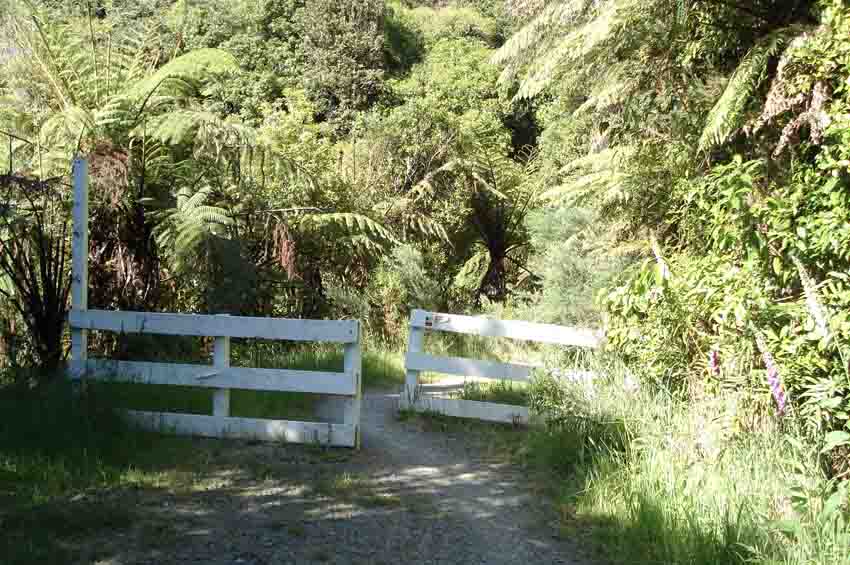
It was another glorious morning. Here is the early sunshine on this typical gate.

The whole way on this walk, I was close by the Kahuterawa Stream, at varying heights above it. The sound of the stream, and the sunshine on the water, made for a very pleasant walk.
This second stream photo is taken from the Black Bridge near where the Sledge track and Back track begin.
There were a few places where I saw flax bushes in full flower: this one had a tui feeding on it.

There was a car park just before Sledge track, and it had this super-dooper long drop. Very clean , even had toilet paper, and running water in the basin. Five star. (And I put it to good use if you are wondering!)

It took about an hour and a half to get to the car park. Saw an accident when a car going into the car park collected a descending mountain biker. But fortunately he and his bike were OK. The other not-nice thing on this walk was that I saw a nearly-dead sheep by the side of the road. It needed to be put out of its misery, poor thing, but I had no way of doing anything. (It was still alive -just- when I returned downhill.) Some mountain bikers suggested ringing the SPCA, but there was no cellphone coverage up there.

I walked just the first twenty minutes of the Sledge track. Some climbing stretched up at the point where I left the track, but I had been walking two hours by then, and I had decided to do four hours all up. Maybe tomorrow! The walk back to my car was in full sunshine. Yet another glorious day, discovering the walking opportunities close to home.

Saturday, December 15, 2007

An early start!

I did what I will need to do on the Camino if I end up walking in Spain in the summer... I got up early! By quarter past six I was parked at my friend's place and began the 22km or so walk around onto Greens Rd and back down Kahuterawa Rd.
I am still a bit besotted with rural letterboxes: I like the way this 'standard plastic' one has been turned into a 'whale'!
Today on Tiritea Rd I found the lower entrance onto the green corridors part of the path, which meanders near the stream. (I had missed the sign last time, but today I found it, somewhat obscured by the long grass that has grown.) There were even lovely seats to sit on near the stream: one day when I am doing a shorter more relaxed walk, I will sit on them! It will be interesting to see how much the trees have grown in two more years. Some people are doing wonderful work here.

The only 'issue' with taking the corridors path was that I did need to cross the stream three times. Not that I mind crossing streams - I quite like it. But at one crossing my shoes got very drenched and I squelched along for a while after that. The interesting result of adding 'moisture' to the mix was that I ended up with a small blister, in an unexpected place, and I haven't had any other blisters before with these shoes/socks. Next time I might carry a change of socks.
Below is a view of the farmland part of the Greens Rd route. This track really does get up into the hills near PN.
There were quite a few mountain bikers on Greens Rd today, also out early-ish to avoid the heat. Here are two disappearing rapidly into the distance, on one of the few descents in this direction, until you drop back down to Kahuterawa Rd.

And when I got home I had a siesta. Then my rest was interrupted by a phone call for a Colmar-Brunton survey of some kind that I never bothered to find the reason for. Don't those surveyers pick the worst times to ring??!!

OK this is my blog and I'll do a rant if I want to! You are free to ignore it - you have been warned!! It was "Carols by Candlelight" in the Square in town this evening. Now, I haven't even been to this often, but I have been when the Sally Army basically did all the music and sang lots of carols with lots of verses, and not much talking in the middle. And the atmosphere has been lovely. Now it appears that the fundys have taken over with their ra-ra stuff. It was advertised to start at 8pm, but when I arrived at 8.15pm I had to listen through Miss Teen NZ being interviewed (not sure what that has to do with Christmas) and some ra ra proselytising singing. At 8.30pm the carols got underway, and the Sallies only had a very brief section, with lots of ra ra commentary in between and not many verses of many of the carols. Then we got the ra ra fundy group that repeated some of the same carols. And lots of ra ra commentary. So I left early. Give me lots of carols by the Sallies and less of the ra ra. Actually, it won't matter.... cos I won't return again. Maybe the Sallies will have their own event somewhere sometime......

And just so I don't end on too sour a note. I did see quite a few kids from school there. And some of them were having a wow of a time dancing etc. So it's just old fogeys like me maybe who have our noses out of joint;-)

Saturday, December 01, 2007

Tiritea -Greens- Kahuterawa- Old West Circuit

Today I decided that Camino training had to get serious, and planned out a route that I thought might be close enough to 25km on some local rural roads. There are two reasons some of these roads recently came to my attention. #1 is that my income for the next few months will be limited, so I need to train close to home. #2 is that there has been recent publicity, as local routes have been opened linking into the Te Araroa route that is proposed to traverse NZ eventually.

I hit the carpark on Old West Rd for the Upper Tiritea Walkway at 7.30am. Given the brilliant sunshine already, I could well have done with more discipline and got here at first light. Ahhh maybe another time! I discovered quite a few new things about my local area in this walk, despite the fact I have lived in PN for nearly 23 years now! First thing was that I never knew they were creating 'green corridors' on Tiritea Rd. And it would seem I could have walked close to the stream somewhere near here as well, but I missed the walkway sign at the bottom and only found it at the top. (Something new remains for another day!)

The skies were blue and the sunshine was gorgeous.

Passed this horse happily munching in a field on Tiritea Rd so took a photo for Lorenzo!

From Tiritea Rd I ended up on what I think is one end of Greens Rd. Only traffic that passed me was a water tanker. The lack of rain must already be troubling rural dwellers. Then I reached a section of Greens Rd that has been closed to vehicles, and is narrower. It was lovely walking here, until a mountain biker came zooming downhill and nearly collected me! Met two other walkers, and one of them was a parent of a former pupil. It's funny really that I nearly always meet someone I know when I am out walking. But I guess you meet a lot of people over time when you are a teacher.

Another blue skies shot. Couldn't resist it really. Good practice for Spain walking in all this sunshine I guess, but I was starting to use more water bottle more often by this stage of the morning!
The route felt fairly gentle mostly. But looking back you could see how in places there had been a bit of a climb.
So maybe it shouldn't have come as a surprise when I finally emerged out to a view over Kahuterawa Rd and the Manawatu plains below. It was a surprisingly big descent down to Kahuterawa Rd, yet I hadn't felt as if I had climbed much.

Here is another photo dedicated to Lorenzo the Llama. On Kahuterawa Rd I met up with these two riding horses. (I had seen them earlier on their outward route along Greens Rd.) They realised I must have walked quite a distance and offered that I could call in if I needed a lift the rest of the circuit back to my car. Maybe I looked old and tired!
However, the more difficult parts of the walk were already behind me, and not much more than an hour after I saw the horse-riders, five hours after I had started, I was back at my car. Last weekend after my shorter rural walk up Kahuterawa Rd, I had felt like I was betraying the countryside by hopping in my car at the end. This time I sank into it gratefully, with no guilt whatsoever!