Thursday, March 07, 2024

Millers Flat and the Clutha Gold Trail

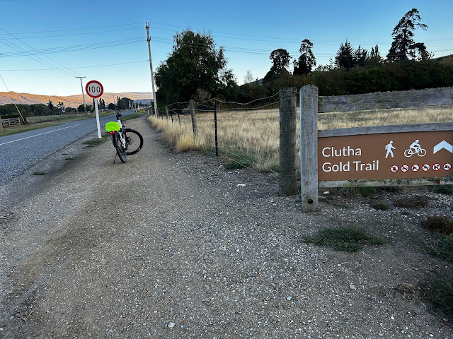
 I knew that I wanted to cycle some of the Clutha Gold Trail, and wasn’t sure where to camp. A friend recommended Millers’ Flat, which had tracks upstream and downstream from there. So I did, and what a great place it was. I was given a perfect spot for my small tent, that was sheltered from the wind, had shade from the sun, and overlooked the Clutha. And the camp facilities were immaculate.

I stayed three nights and did two different parts of the trail. The first day I headed upstream to Roxburgh, which on my bike was just over 40km all up. Great ride! There were lots of trees along the way, and for much of it you rode within sight of the river.


Finally, you crossed the bridge and into Roxburgh, where I had a delicious scone and cold drink.
For my second ride I decided to drive down to Beaumont and head upstream from there, as I thought it might be a bit much for me to do 50km return from my tent site. (Maybe another day…)

There is a huge carpark at Beaumont, beside a new bridge over the Clutha.


The trail heads upstream beside a very quiet rural road, and even on the road in places, but I only saw one car and two trail bikes the whole time I cycled.

There was an old car in a field, right opposite an old building- perhaps a shop in the gold era even?? There was a seat there in the sunshine where I enjoyed some morning tea.


Here are a few more Clutha views - Stones of the Central Otago kind were in the water in places.


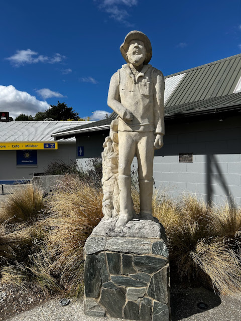
I had lunch in Lawrence, where I saw this early miner...

I finished the day in my campsite at Millers Flat, overlooking the Clutha. I highly recommend this bike trail, as well as staying in this campground as a base.

Hooker Valley Track

 I have been on this track at least five times now- and only once before had the clear views that I was so grateful to experience this day. But this day had a combination of early mist and later clear skies that was absolutely magical.

From the camping ground at Glentanner, I could tell that the top of Aoraki was all clear, but a wide band of cloud was at the base. I drove towards the mountain, in clear skies at first, but then in heavy mist. I started the walk hopeful that things would clear as the morning progressed.


I was past the third bridge before glimpses of the mountains began to show. 


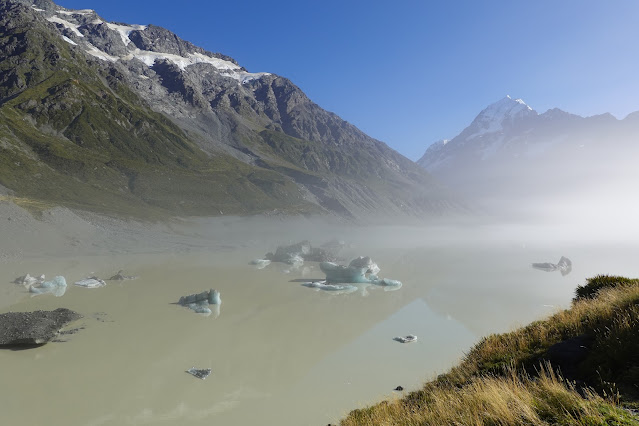
At the viewing place by the glacier lake, heavy mist was still around, but I decided to stick around with a bunch of others, in the hope that the mist would clear. 

And as things cleared, it was almost a mystical experience. 


Sunlight poked through and showed the ice chunks in the lake that I had not previously seen.


Peaks started to show themselves, then would be covered with mist again. 


Aoraki was the last to show herself. By about 11am all was clear.

I didn’t want to leave the viewing place and had to force myself to begin walking back downhill.


This time the bridges were clear instead of shrouded in mist. And as I descended hordes of mostly tourists were ascending, and I was glad that I had started earlier in the peace (and cool) of the morning. What a precious day. Ka Kite Aoraki.


Lake Pukaki Foreshore Trail

After the previous day’s longish ride along the Tekapo Canal, I was quite glad to choose a shorter one next- the return trip along the Lake Pukaki Foreshore Trail.

When I reached the first lookout over the lake, on the highway from Tekapo, it was time to turn off down Hayman Rd, where after a km was the sign for a small carpark for the foreshore trail. 
 

I unloaded my bicycle from the car and I was off. 

It was a beautiful day for the ride- calm, sunny, and with great views across to the mountains.

 At the other end of the trail, some 8.5km away, there was a bike stand made with the plastic trays from the salmon farm I had seen the day before. (And yes, the fatter tyres on my bike didn’t rest easily on this, but could easily be leaned on the end.) 


On the map on the back of the sign, I could see that Twizel was only 11km away, but I kept to my ‘rest day’ plan for riding, in case it was a good day for the Hooker Valley walk next day.

The views were even better on the way back, though I met a few more cyclists, my timing coinciding with a paid group. 


The trail was well signposted for all though, in both directions.

My favourite spot along the trail was this little table, in a spot that was free from the campervan hordes! I sat and quietly enjoyed some morning tea before continuing back to my car. 


Thursday, February 29, 2024

Tekapo Canal

 The cycling part of my holiday has begun. I cycled along part of the Tekapo part of the Alps to Ocean journey, starting down along the Canal road where cars were excluded. This route was partly gravel and partly sealed, and I had a 20km trip down until there was a steep drop-off and a view of Lake Pukaki. Then a 20km return. Very flat and barely any breeze. 

The barrier that kept most cars out- though a Genesis vehicle did come through, driving very considerately. The design for the cycle part is very clever. You can wheel your bike through the wider section while moving through the adjoining bit yourself. 

The first part of the route was really just me and the canal. The sloped ‘hills’ either side were very brown and dry. As I progressed along, the view opened out to the ranges. On my return I caught some reflections of the ranges in the water of the canal. 


At a convenient 11km of my journey was a toilet and picnic table. I presume one of the companies that takes groups along here provided it, but I was grateful at the time!

At the end of 21km I reached this viewpoint down over Lake Pukaki. It was my endpoint for the day. It was a place where fishermen were hopeful. And I retraced my ride back to my car. 

Last photo- my wifi is slow and daylight is coming to an end at the camping ground. (More another day.)
This last photo is of a section of the salmon farm, which started at 16km of my journey, and stretched along for a surprising distance. Workers were feeding the fish as I cycled past, but had mainly finished on my return journey. 


Saturday, February 24, 2024

Duvauchelle sojourn

 Between a family reunion and a wedding in Christchurch, I spent several nights in Duvauchelle exploring Banks Peninsula. I loved the peacefulness of the camping ground. Here is a selection of photos.

The interior of the Catholic Church in Akaroa.
Akaroa building.
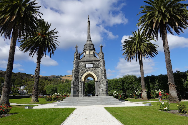
War memorial in Akaroa. 
Another French style building in Akaroa. 
Boat sheds in Duvauchelle 

Whaling pot along the harbour front in Akaroa.
Heron finding food in Duvauchelle. 
The view from the Summit Rd. 
The view from my tent site in Duvauchelle. 

Two different sunsets on successive nights.